NAVIGATION SIMULATOR
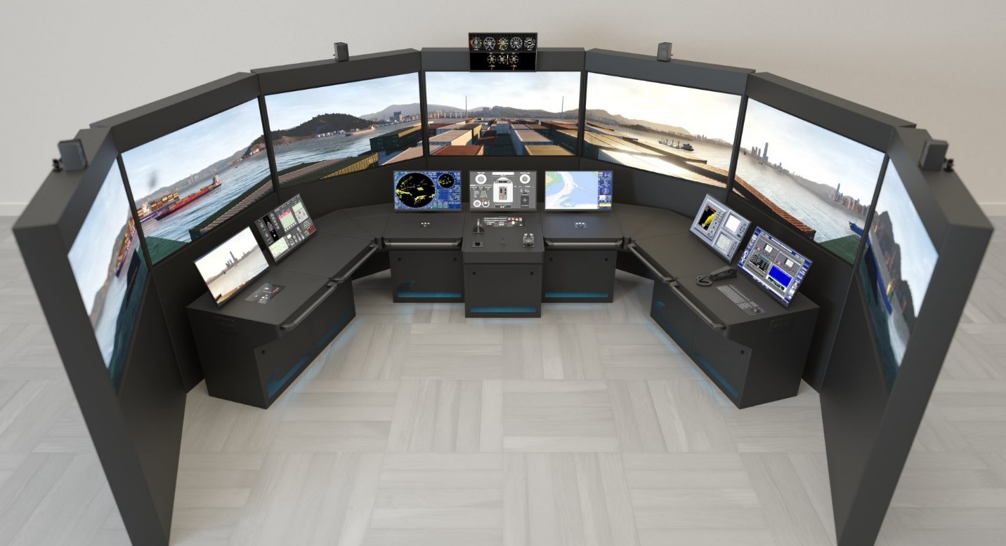
The CIFMAR simulator consists of a complete real navigation bridge, with high Dutch technology, which includes the consoles and controls found on the bridge of a modern ship, including the steering system (manual and automatic), the telegraphs of machines, transverse thrusters (Bowthruster – Sternthruster), and azimuth controls for port and offshore tugboats; all with NFU control systems, anchor control for anchoring maneuvers, gyrocompass repeater, including binoculars for visualization of mooring and unmooring maneuvers in docks.
The NAUTIS CIFMAR simulator is certified by the Norwegian classification agency DNV-GL as "Integrated Simulator System, Tug, Fishing mode, HSC", Full Mission Class "A". The system simulates navigation maneuvers, mooring/unmooring to docks, mooring and unmooring to MONOBOYA and Multibuoys, ship-to-ship maneuvers, navigation in the main traffic devices in the world, use of ropes and tugboats, all types of failures and events, navigation in restricted waters in different visibility conditions (day and night) with different weather conditions.
It has the ability to record the maneuvers that can be extracted later through an analysis for later viewing. Nautis Simulator has all kinds of ships to carry out the practices, such as: Container Ships, Oil Tankers, Oil Tankers, Gas Carriers, Platforms, Ro Ro – Car Carrier, Ferries, General Cargo, Bulk Carriers, Cruise Ships, Naval Unit, Port Tugboats , Offshore Boats, Pilot Boats, Barges, etc.
Practice Ports
- Port of CALLAO, Terminals of APM, DPW, Ex-Andesa, TCSA and Naval Base.
- Terminal MONOBUOY PAMPILLA
- Multibuoy Terminal in Pampilla, Oquendo and Conchán.
- English Channel, including port of Dover – UK, France
- Strait of Gibraltar, including the port of Algeciras and Gibraltar – Spain and Gibraltar
- Rotterdam-Europort-Netherlands
- New York including Newark – USA
- San Francisco – USA
- Rio de Janeiro-Brazil
- Hong Kong–China
- Singapore Strait – Singapore
- Strait of Hormuz – UAE, Iran and Oman
- Bosporus–Turkey Strait
Navigation Simulator Equipment
- Electronic Charts (ECDIS) Electronic Chart Display and Information System
- RADAR/ARPA (Automatic Radar Plotting Aid) – Bands (XS)
- AIS (Automatic Identification System)
- GMDSS (Global Maritime Distress and Safety System)
- SART (Search and Rescue Transmitter)
- Equipment such as GPS, Gyrocompas, Echosounder, Log, Data Voyage Recorder (VDR), Navigation Lights, Servomotor Alarms, Fire Alarms, Anchor Winch Control, etc., Propulsion System Alarm Panel and Auxiliary Machines.